Click to see Full Size Map
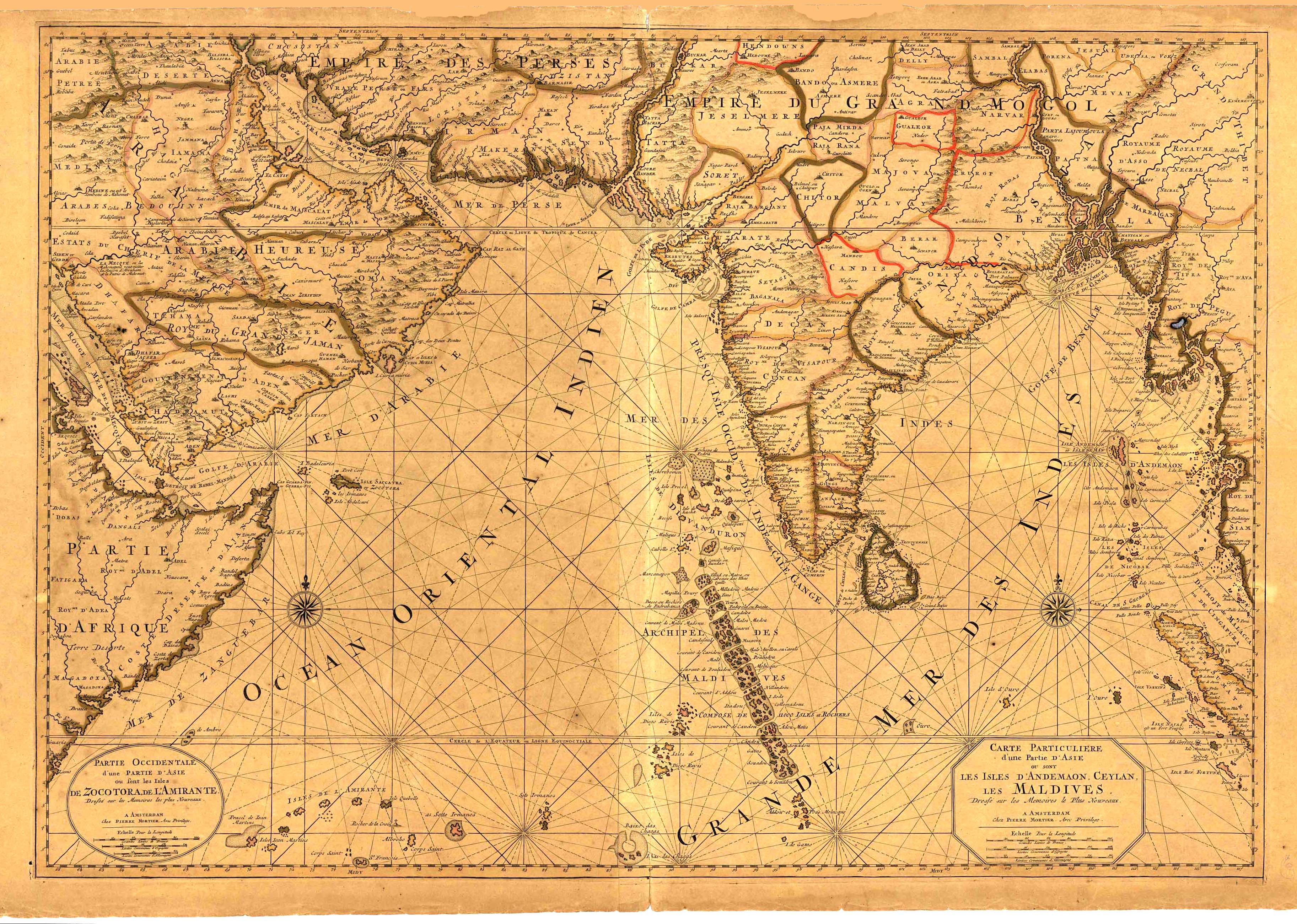
| Description | Map of South Asia, Maldives, Ceylan, India and Andermons, |
| Back | Blank |
| Cartographer | Pieter Mortier (1661-1711) |
| Publisher | |
| Language | French |
| Publication Place | Amsterdam |
| Publication Date | 1700 |
| Map Dimensions | 34.5 x 24 inches |
| Color | Hand Colored |
| Source | Mortier issue of the Neptune Francois |
Focus centered on India, the charts extend from the Horn of Africa in the west to the Straits of Malacca. The chart includes both rhumb lines and details in the interior of the covered regions.
Together, the two sheets highlight the major trading islands and entrepots which were then the gateways for European traders to Asian goods. It also shows areas under Ottoman control, highlighting the disputes that often erupted over trade rights and access and which were underwritten by religious difference.
These maps were integrated into the expansion of the most famous sea atlas of the seventeenth century, the Neptune Francois. As published in Amsterdam, this third part of the work, Suite du Neptune Francois, ou Atlas Nouveau des Cartes Marines, contained maps prepared for the king of Portugal.
Pierre Mortier (1661-1711) was a Dutch engraver, son of a French refugee. In 1690 he was granted a privilege to publish French maps in Dutch lands. In 1693 he released the first and accompanying volume of the Neptune Francois. The third, with these charts, followed in 1700.
The highlighted islands emphasize the importance of ports and stopping places to Europeans hungry for Asian trade. This is a fine example of this highly sought-after map.
100 dpi Digital scans of 17th-19th Century Maps with Ceylon in the Collection of
Mr Percival Upajiva Ratnatunga (1911-2003), Survey General of Ceylon 1967-68.
The original Maps were purchased by him in Post World War II, London