Click on image to see text on the back of Map
Click for Full Size image of Map Back
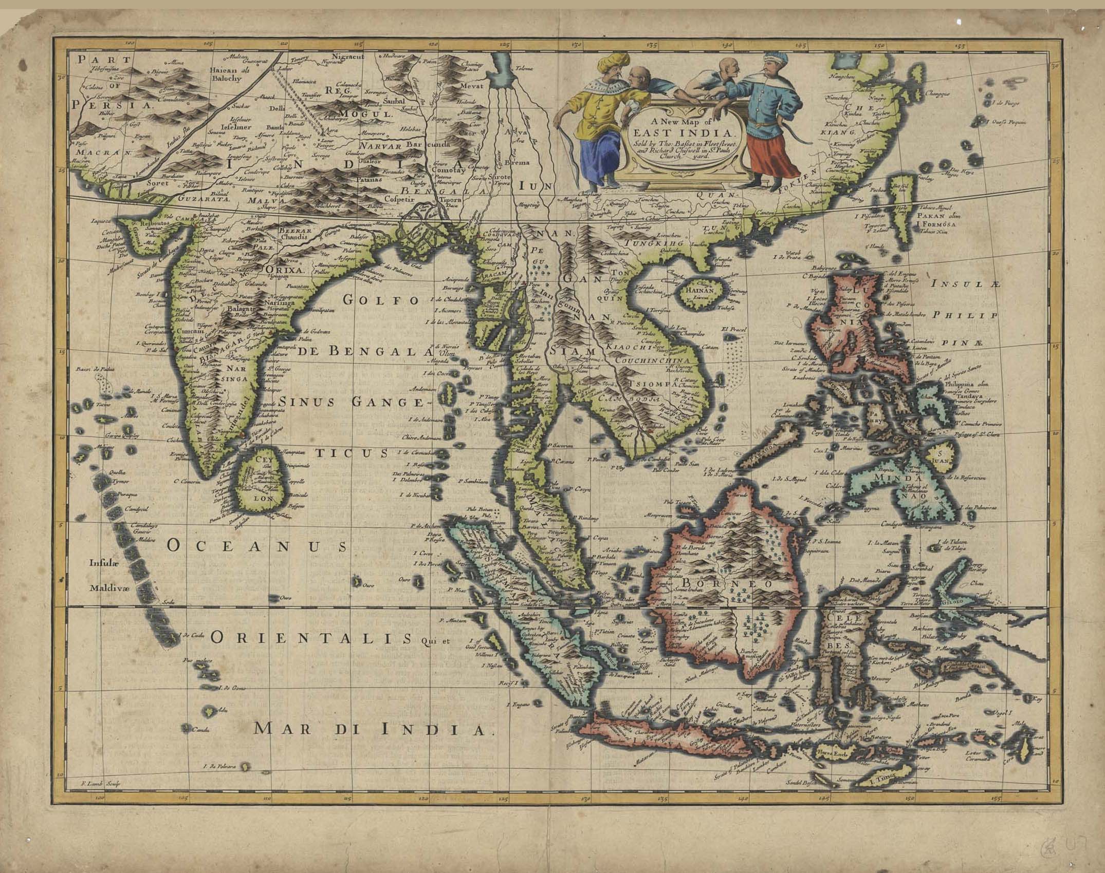
| Description | Map of East India |
| Back | The Description of India P 52-51 |
| Cartographer | Francis Lamb (Engraver) |
| Publisher | Thomas Basset and Richard Chiswell |
| Language | English |
| Publication Place | London |
| Publication Date | 1676 |
| Map Dimensions | 19.5 x 15 inches |
| Color | Hand Colored |
| Source | A Prospect of the Most Famous Parts of the World by John Speed (1552-1629) |
Map of EAST INDIA sold by The Basset in Fleet Street and Richard Chiswell in St Pauls Church yard
100 dpi Digital scans of 17th-19th Century Maps with Ceylon in the Collection of
Mr Percival Upajiva Ratnatunga (1911-2003), Survey General of Ceylon 1967-68.
The original Maps were purchased by him in Post World War II, London