Click to see Full Size Map
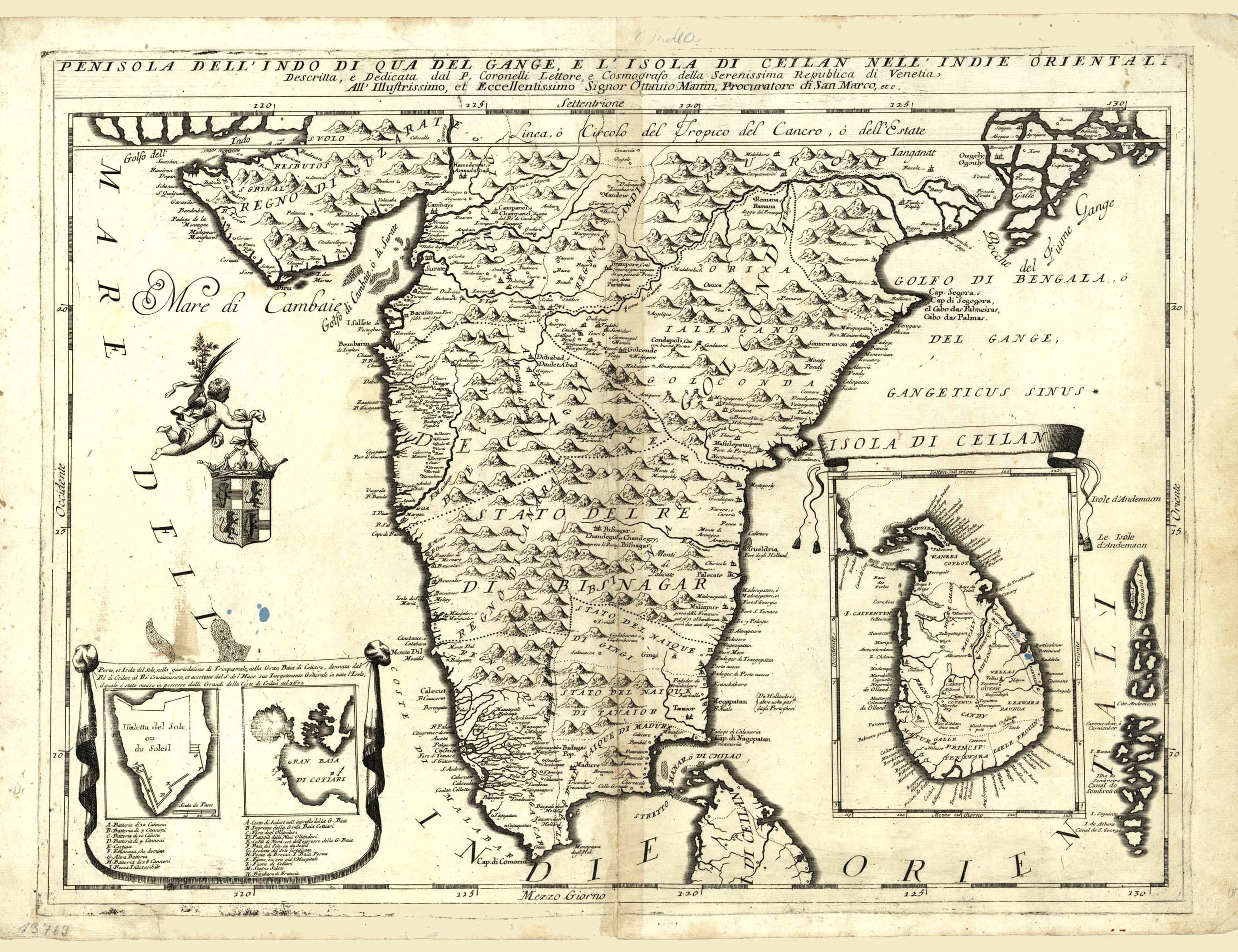
| Description | Peninsula Of The India and Island Of Ceilan in East Indies |
| Back | Blank |
| Cartographer | Vincenzo Maria Coronelli (1650-1718) |
| Publisher | |
| Language | Italian |
| Publication Place | Venice |
| Publication Date | 1690 circa |
| Map Dimensions | 25 x 18 inches |
| Color | Hand Colored |
| Source |
The map shows India below the Tropic of Cancer, with an insets of Ceylon and Trincomalee.
Vincenzo Maria Coronelli (1650-1718) is one of the most influential Italian mapmakers and is known especially for his globes and atlases. At sixteen he published his first book, the first of 140 publications he would write in his lifetime. The order recognized his intellectual ability and saw him educated in Venice and Rome. He earned a doctorate in theology, but also studied astronomy. By the late 1670s, he was working on geography and was commissioned to create a set of globes for the Duke of Parma and later for the French King Louis XIV, which led to a craze for Coronelli's work and he traveled Europe making globes for the ultra-elite. By 1705, he had returned to Venice. There, he founded the first geographical society, the Accademia Cosmografica degli Argonauti and was named Cosmographer of the Republic of Venice.
100 dpi Digital scans of 17th-19th Century Maps with Ceylon in the Collection of
Mr Percival Upajiva Ratnatunga (1911-2003), Survey General of Ceylon 1967-68.
The original Maps were purchased by him in Post World War II, London