Click to see Full Size Map
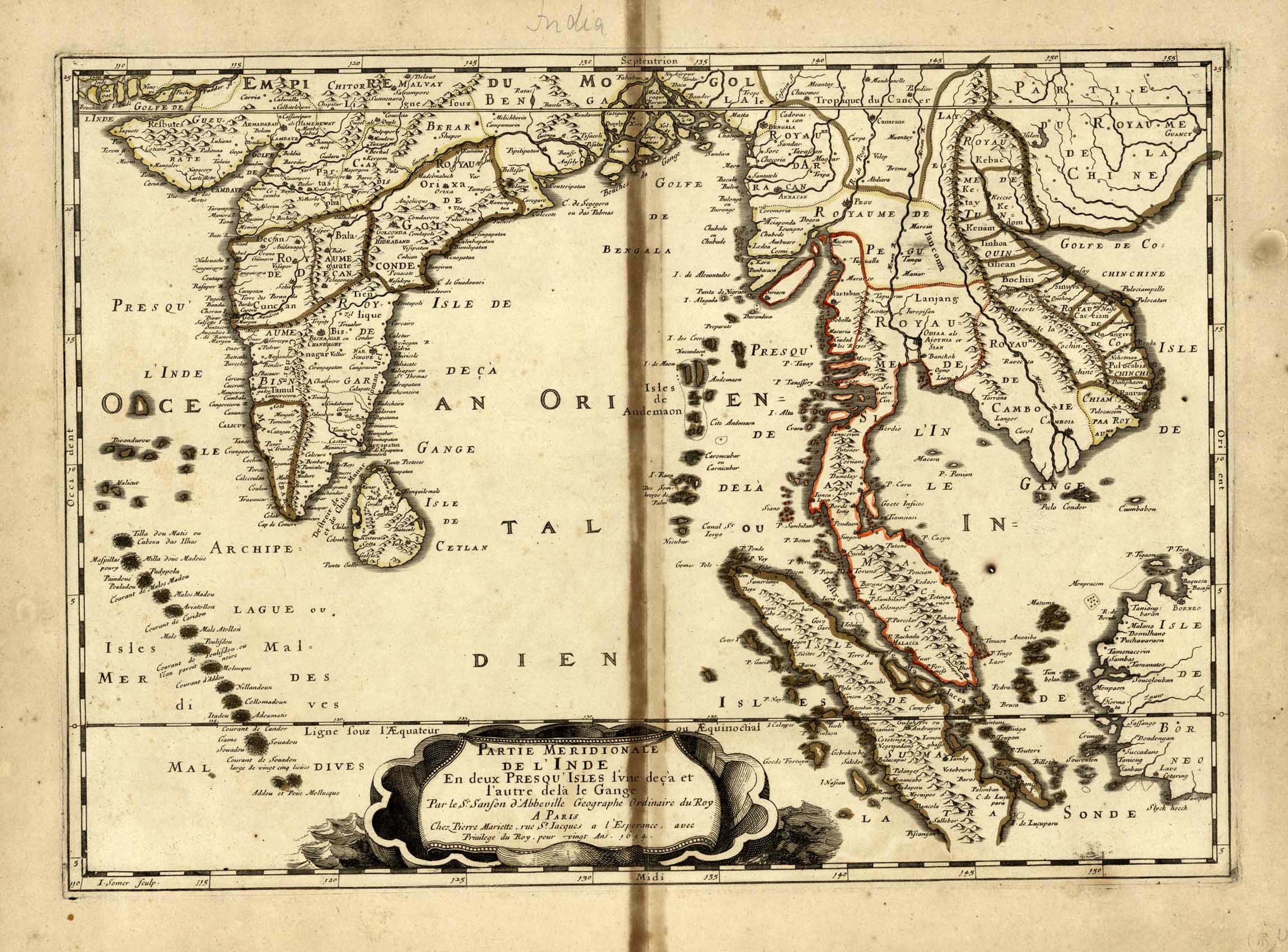
| Description | Map of Ceylon, India and Southeast Asia |
| Back | Blank |
| Cartographer | Sr Nicolas Sanson (1600-1667) of Abbeville |
| Publisher | Pierre Mariette |
| Language | French |
| Publication Place | Paris |
| Publication Date | 1654 |
| Map Dimensions | 20 x 15. inches |
| Color | Hand Colored |
| Source | Sanson's Atlas Les Cartes Generales de toutes parties du Monde (General Maps of all parts of the world) |
First published in 1654 and issued separately, then included in Sanson's Atlas Les Cartes Generales de toutes parties du Monde, first issued in 1658. Engraved by Jan van Somer, the map shows the whole of Ceylon. It shows the cities and smaller settlements, rivers and mountain chains, as well as the borders of the seventeenth-century kingdoms and other major political divisions, most of them further subdivided.
Nicholas Sanson (1600-1667) is considered the father of French cartography in its golden age from the mid-seventeenth century to the mid-eighteenth. Over the course of his career he produced over 300 maps. His success can be chalked up to his geographic and research skills, but also to his partnership with Pierre Mariette who died in 1657, and Mariette's Son also Pierre, who helped to continue the publication.
100 dpi Digital scans of 17th-19th Century Maps with Ceylon in the Collection of
Mr Percival Upajiva Ratnatunga (1911-2003), Survey General of Ceylon 1967-68.
The original Maps were purchased by him in Post World War II, London