Click to see Full Size Map
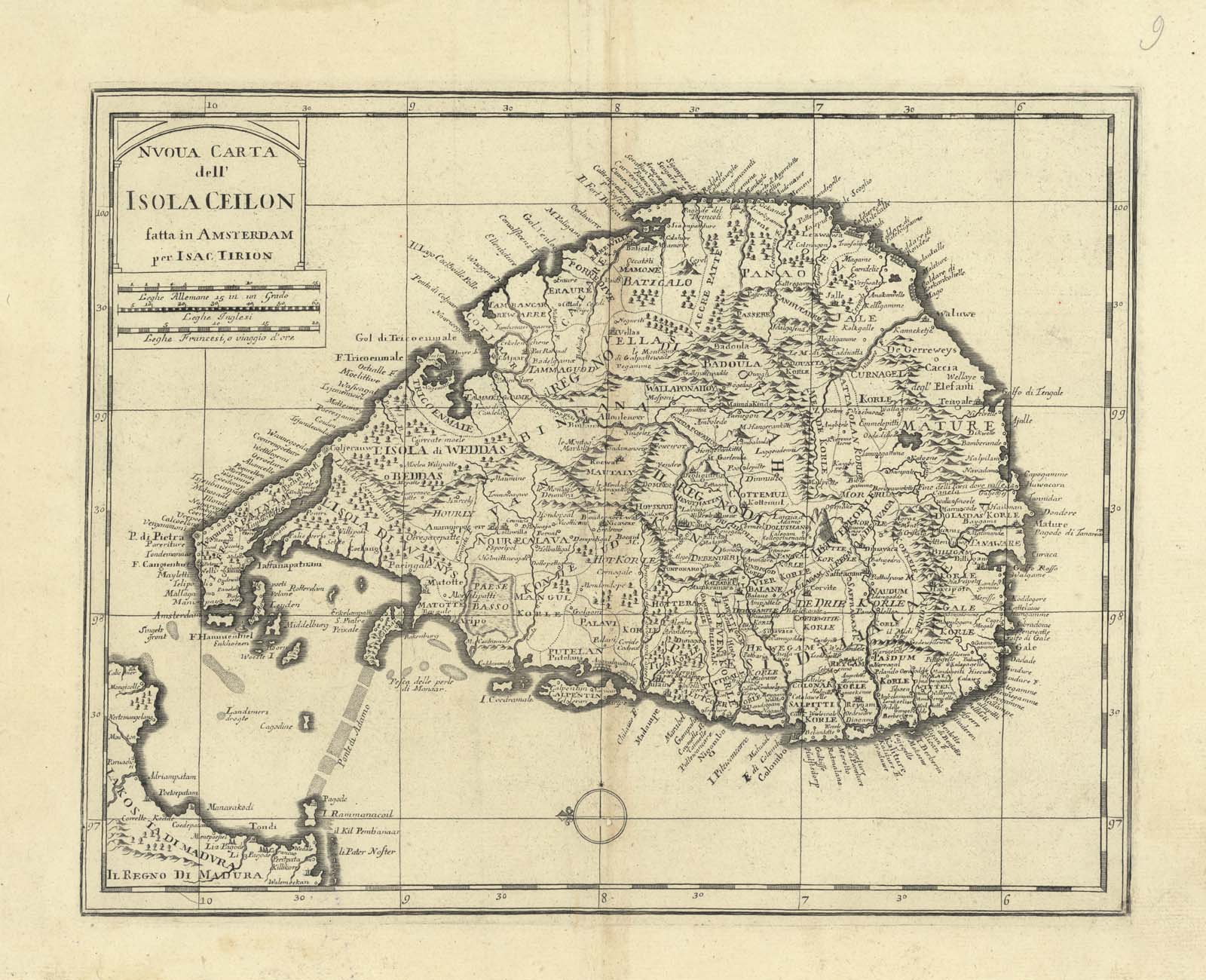
| Description | Map of the Island of Ceilon |
| Back | Blank |
| Cartographer | Isac Tirion (1705-1765) |
| Publisher | |
| Language | Italian |
| Publication Place | Amsterdam |
| Publication Date | 1740 |
| Map Dimensions | 14 x 11 inches |
| Color | UnColored |
| Source | Nuova Carta dell'Impero del Gran Mogol. (New Map of the Great Mogul Empire.) |
Copperplate atlas map.
100 dpi Digital scans of 17th-19th Century Maps with Ceylon in the Collection of
Mr Percival Upajiva Ratnatunga (1911-2003), Survey General of Ceylon 1967-68.
The original Maps were purchased by him in Post World War II, London