Click on image to see text on the back of Map
Click for Full Size image of Map Back
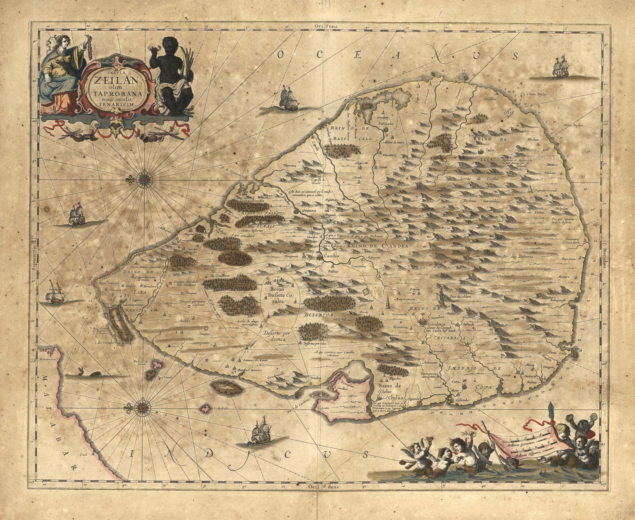
| Description | Map of Zeilan with North to left. |
| Back | Insula Zeilan Olim Taprobana Nunc Incolis Tenarisim |
| Cartographer | Jan Jansson(1588-1664) |
| Publisher | |
| Language | Latin |
| Publication Place | Amsterdam |
| Publication Date | 1650 circa |
| Map Dimensions | 16 x 20 inches |
| Color | Hand Colored |
| Source | Jansson's atlas |
Decorative map of Ceylon, published in the later editions of Jansson's atlas. A striking image, with a decorative title cartouche and scale of miles held aloft by mer-cherubs.
Jan Jansson(1588-1664) was a renowned geographer and publisher of the seventeenth century, when the Dutch dominated map publishing in Europe. Born in Arnhem, Jan was first exposed to the trade via his father, who was also a bookseller and publisher. In 1612, Jan married the daughter of Jodocus Hondius, who was also a prominent mapmaker and seller. Jonsson's first maps date from 1616.
100 dpi Digital scans of 17th-19th Century Maps with Ceylon in the Collection of
Mr Percival Upajiva Ratnatunga (1911-2003), Survey General of Ceylon 1967-68.
The original Maps were purchased by him in Post World War II, London