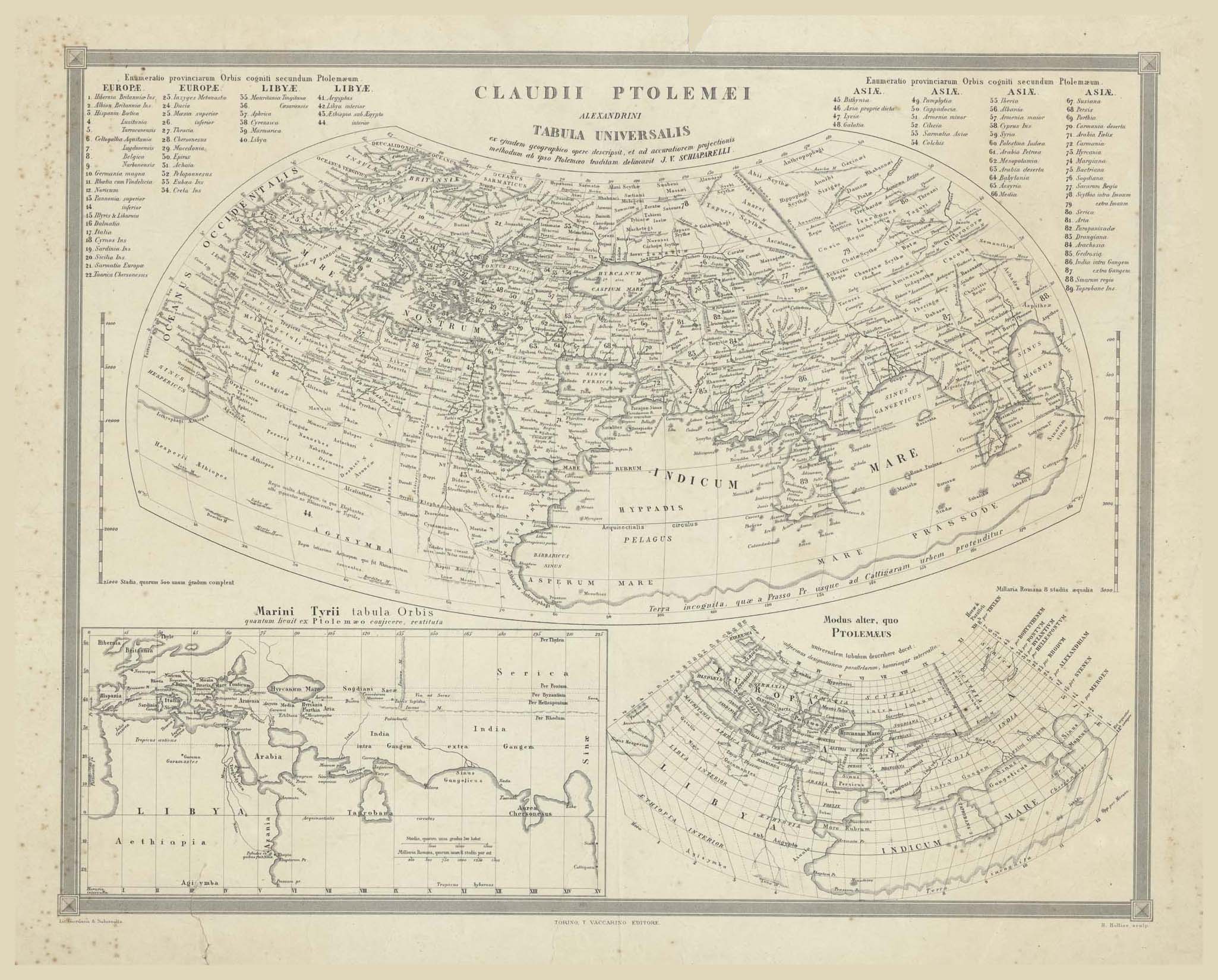
Click to see Full Size Map
| Description | Claudius Ptolemy of Alexandria Universal Map |
| Back | Blank |
| Cartographer | Based on Claudius Ptolemy (0085-0165 CE) |
| Publisher | Litografia Giordana & Salussolia |
| Language | Italian |
| Publication Place | Torino |
| Publication Date | 1860 circa |
| Map Dimensions | 18.5 x 14.5 inches |
| Color | UnColored |
| Source |
T. Vaccarino Editore; H. Bollier Sculp.
100 dpi Digital scans of 17th-19th Century Maps with Ceylon in the Collection of
Mr Percival Upajiva Ratnatunga (1911-2003), Survey General of Ceylon 1967-68.
The original Maps were purchased by him in Post World War II, London