Click on image to see text on the back of Map
Click for Full Size image of Map Back
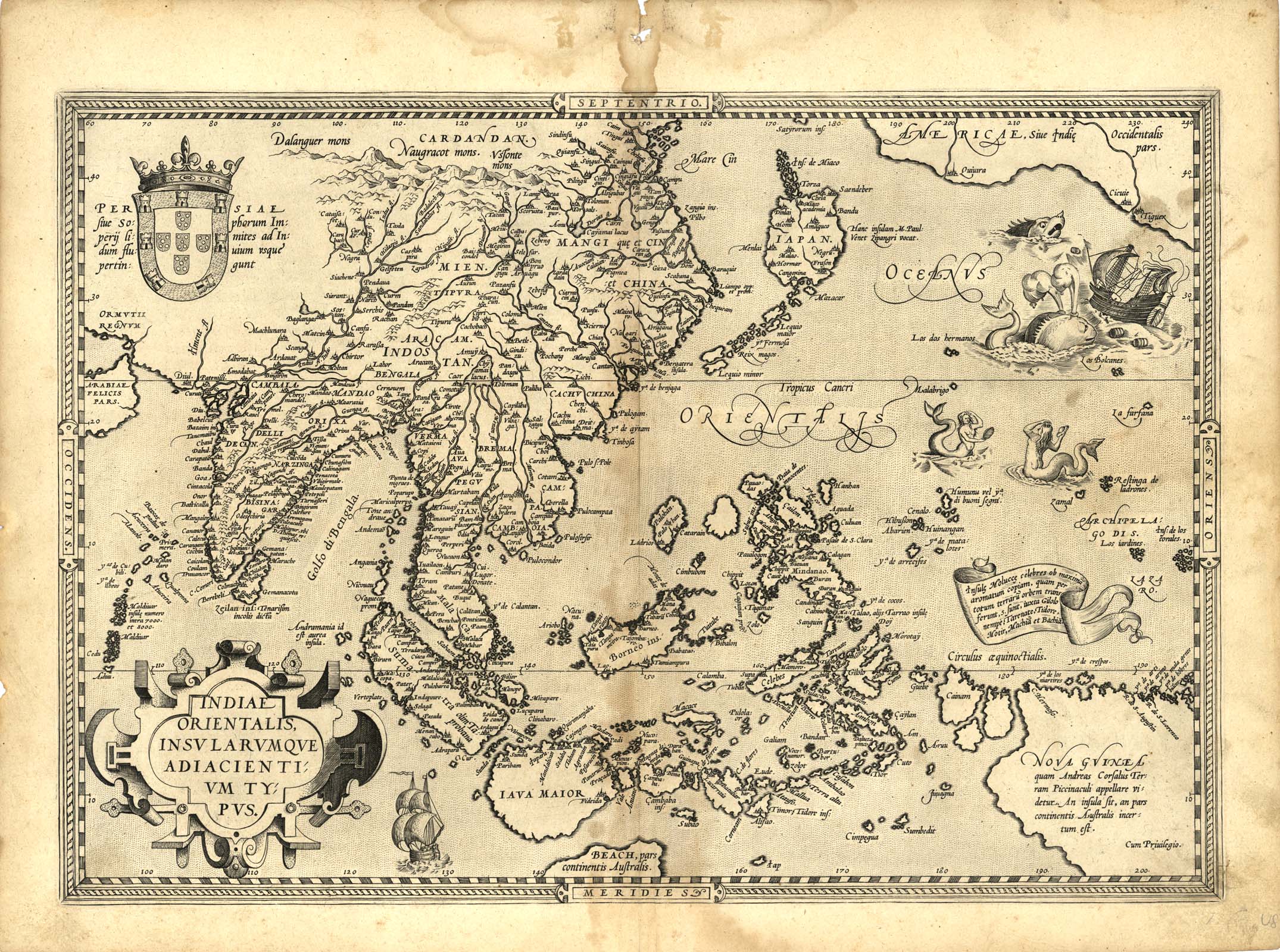
| Description | Map of South and SE Asia up to Japan and California |
| Back | Description of India Page 63 |
| Cartographer | Abraham Ortelius |
| Publisher | |
| Language | Latin |
| Publication Place | Antwerp |
| Publication Date | 1587 |
| Map Dimensions | 19.5 x 14 inches |
| Color | UnColored |
| Source | Ortelius' Theatrum Orbis Terrarum (the first modern Atlas). |
The map is based upon Mercator's world map of 1569.
The map includes Beach and other information drawn from Marco
Polo. The map also includes a portion of the West Coast of North
America, including several mythical names in West Coast of California.
The difficulty of mapping this archipelago was such, that for
centuries to come maps of this area remain faulty.
The mermaids who are beautifying themselves rather than heeding
the whales' attack on nearby ships, are based on those occurring on
Diego Gutierrez map of America.
100 dpi Digital scans of 17th-19th Century Maps with Ceylon in the Collection of
Mr Percival Upajiva Ratnatunga (1911-2003), Survey General of Ceylon 1967-68.
The original Maps were purchased by him in Post World War II, London