Click to see Full Size Map
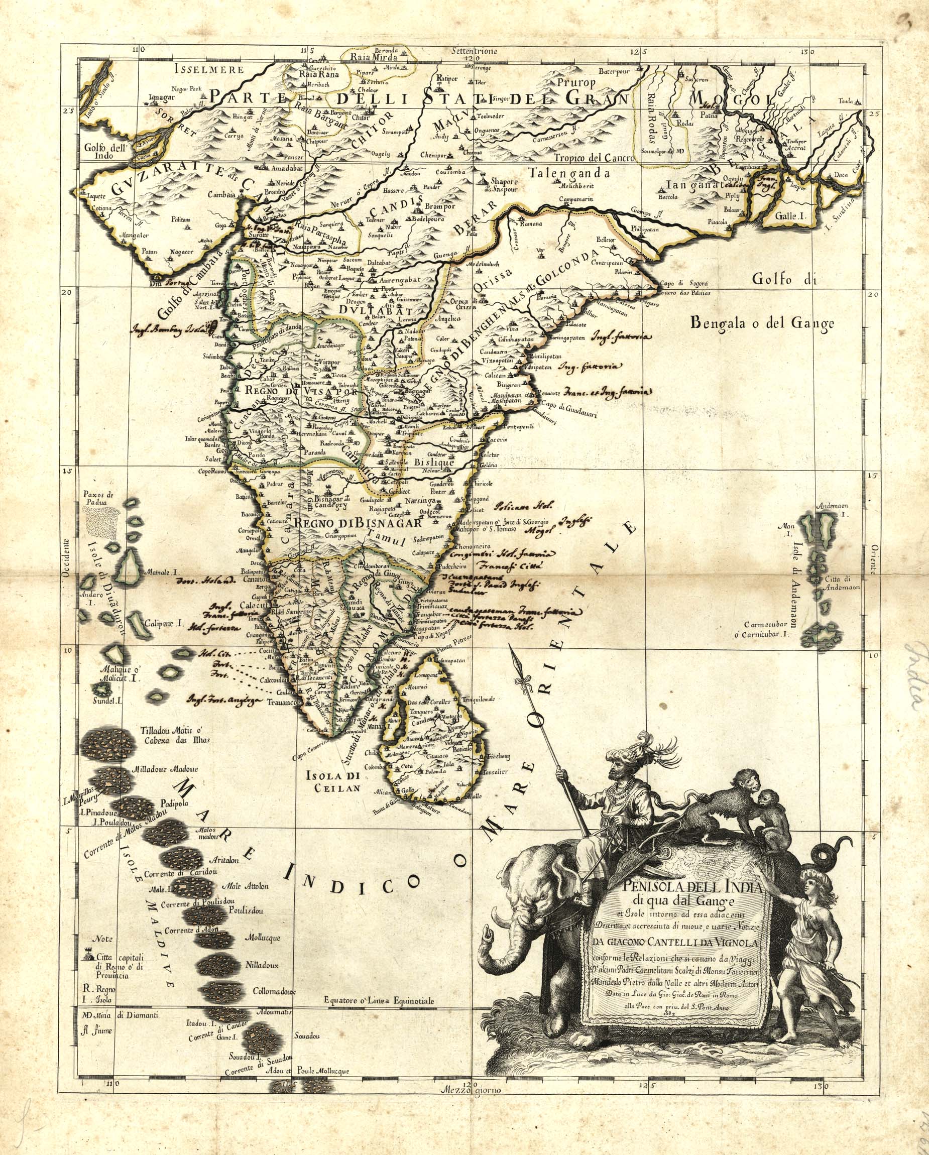
| Description | Map of India, Ceylon, and the Maldives |
| Back | Blank |
| Cartographer | Giacomo Cantelli da Vignola |
| Publisher | Giacomo Giovanni Rossi (1627-1691) |
| Language | Italian |
| Publication Place | Rome |
| Publication Date | 1683 |
| Map Dimensions | 21 x 16.5 inches |
| Color | Hand Colored |
| Source |
Adjoined / described and increased by new and various news in accordance with the reports that arise from the travels of some Discalced Carmelite Fathers of Monsu Tavernier, Mandeslo, Pietro Dalla Valle and other authors. Includes an ornate cartouche, featuring an elephant.
100 dpi Digital scans of 17th-19th Century Maps with Ceylon in the Collection of
Mr Percival Upajiva Ratnatunga (1911-2003), Survey General of Ceylon 1967-68.
The original Maps were purchased by him in Post World War II, London