Click to see Full Size Map
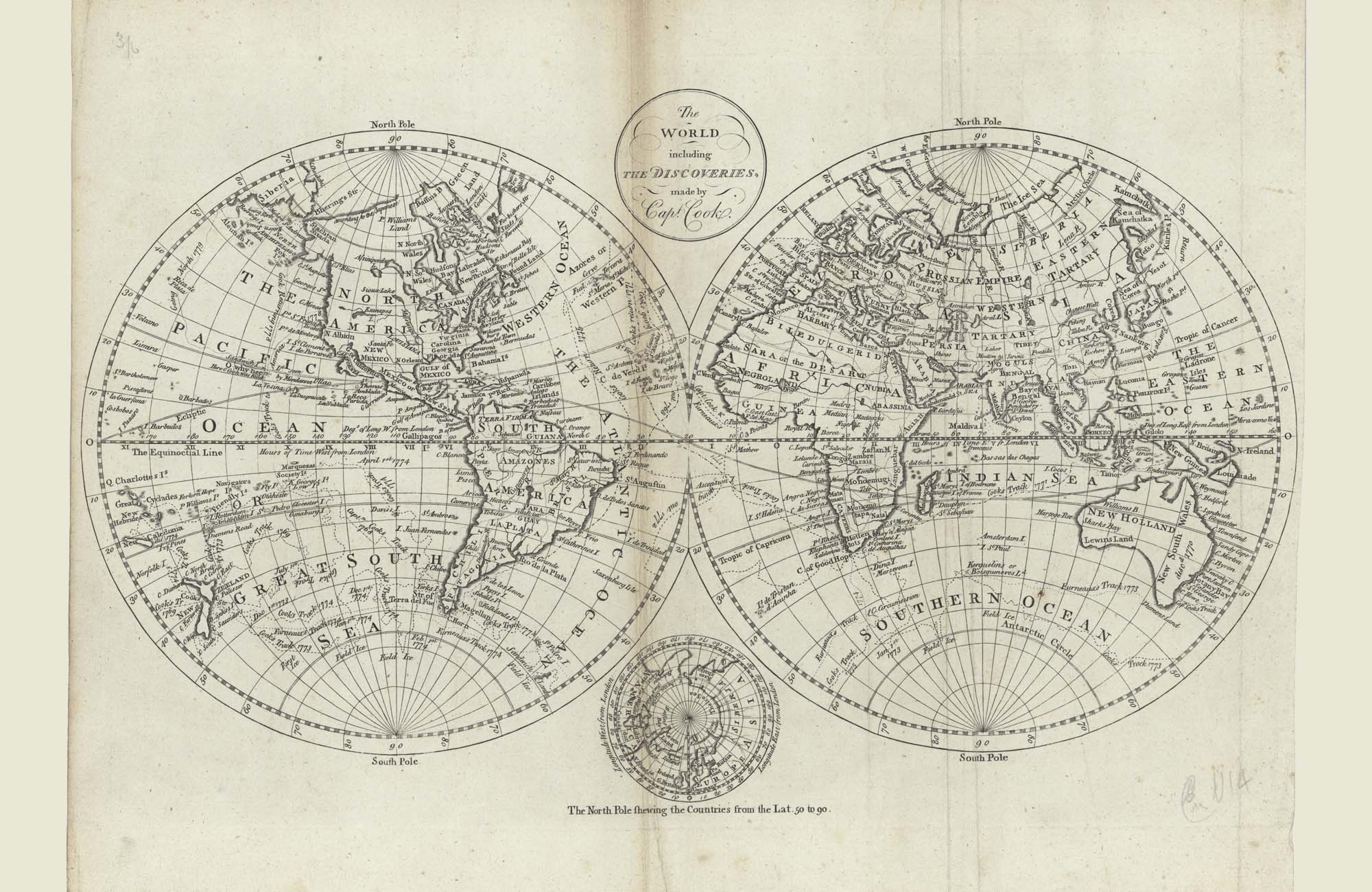
| Description | Double hemisphere of World with discoveries by Capt. Cook |
| Back | Blank |
| Cartographer | - |
| Publisher | - |
| Language | English |
| Publication Place | London |
| Publication Date | 1785 |
| Map Dimensions | 18 x 11 inches |
| Color | UnColored |
| Source | - |
Copper engraved double hemisphere showing the newly discovered coasts of northwest America and east coast Australia, and newly discovered Hawaiian Islands. Vignette at the base of a north Polar view. Cook's routes are shown.
100 dpi Digital scans of 17th-19th Century Maps with Ceylon in the Collection of
Mr Percival Upajiva Ratnatunga (1911-2003), Survey General of Ceylon 1967-68.
The original Maps were purchased by him in Post World War II, London