Click on image to see text on the back of Map
Click for Full Size image of Map Back
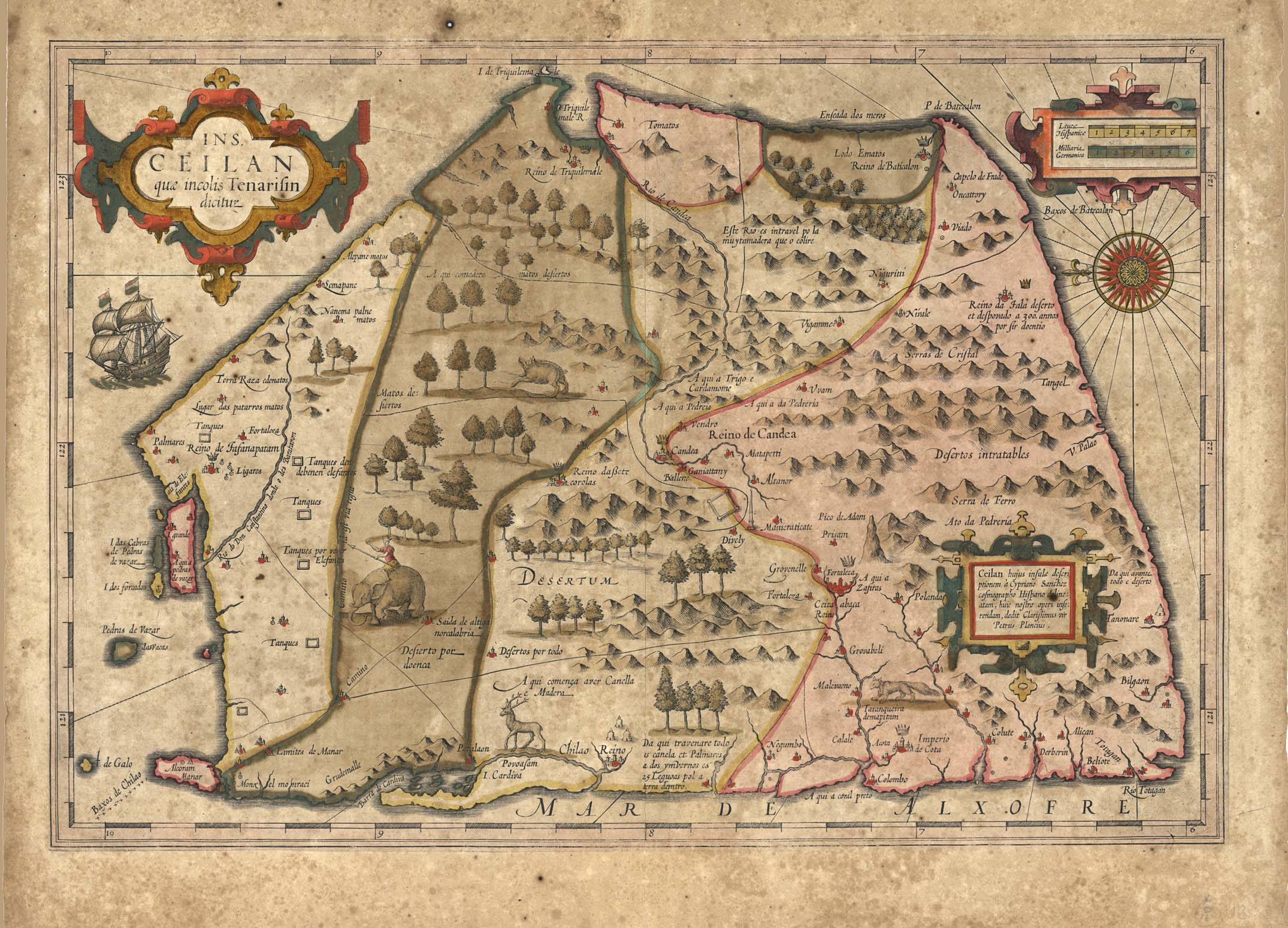
| Description | Ceylon. Unusual five sided shape with North to left |
| Back | Description of the Island of Ceilon |
| Cartographer | Petrus Plancius |
| Publisher | Jodocus Hondius |
| Language | French |
| Publication Place | Amsterdam |
| Publication Date | 1606 |
| Map Dimensions | 13.5 x 19.5 inches |
| Color | Hand Colored |
| Source | Gerard Mercator Atlas |
In 1606 J. Hondius introduced in the Mercator Atlas a separate map of Ceylon, which was prepared by Petrus Plancius, at the time the official map maker of the V.O.C.
A beautiful early map of Ceylon. North is oriented to the left, shown with an unusual five sided shape. This map gives pictorial detail of mountains, roads, forests, villages, kingdoms, mines, stupas and spice plantations. Embellished with three strapwork cartouches, A compass rose, a galleon under sail and animals including a large elephant roaming the interior.
100 dpi Digital scans of 17th-19th Century Maps with Ceylon in the Collection of
Mr Percival Upajiva Ratnatunga (1911-2003), Survey General of Ceylon 1967-68.
The original Maps were purchased by him in Post World War II, London